Earth, Environment, and Geosciences
2215 readers
26 users here now
Welcome to c/EarthScience @ Mander.xyz!
Notice Board
This is a work in progress, please don't mind the mess.
- 2023-06-13: We are looking for mods. Send a dm to @fossilesque@mander.xyz if interested!
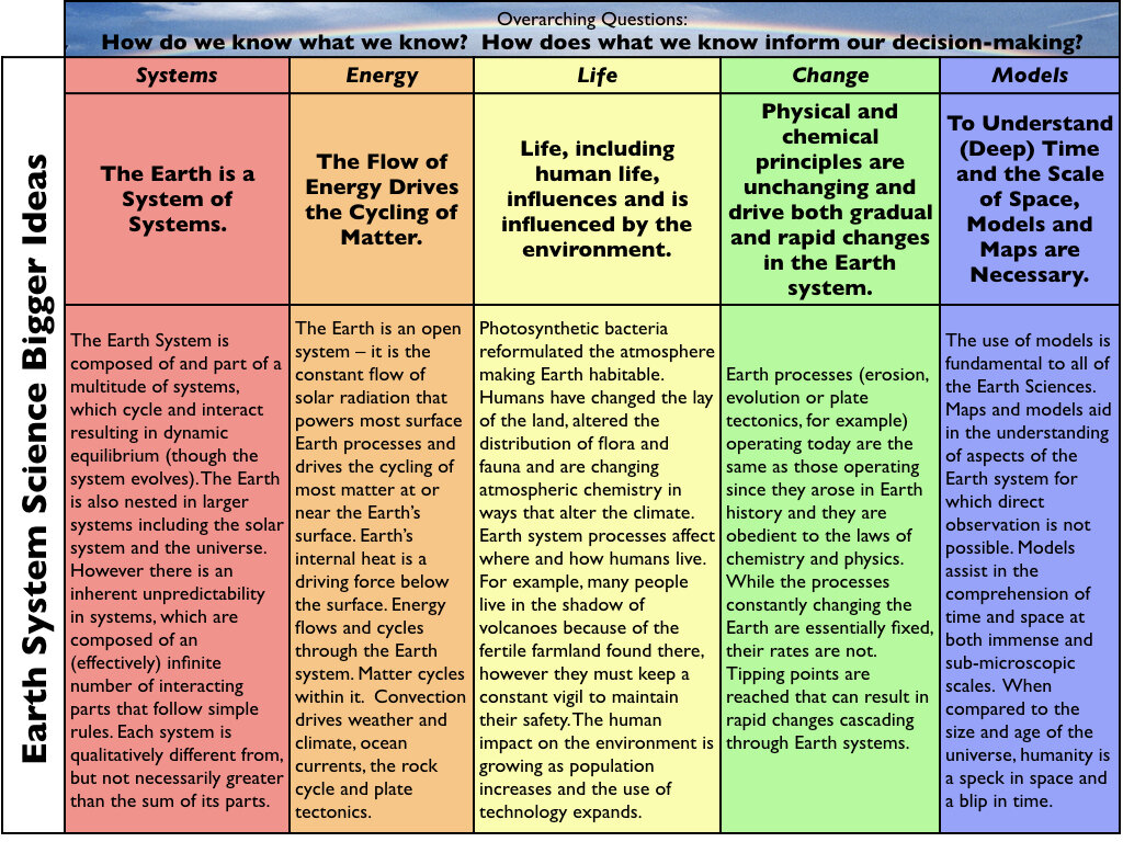
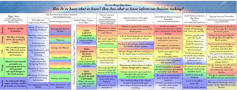
What is geoscience?
Geoscience (also called Earth Science) is the study of Earth. Geoscience includes so much more than rocks and volcanoes, it studies the processes that form and shape Earth's surface, the natural resources we use, and how water and ecosystems are interconnected. Geoscience uses tools and techniques from other science fields as well, such as chemistry, physics, biology, and math! Read more...
Quick Facts
Rules
- Don't throw mud. Be kind and remember the human.
- Keep it rooted (on topic).
- No spam.
Jobs
Teaching Resources
Tools
- GitHub - RichardScottOZ/mineral-exploration-machine-learning: List of resources for mineral exploration and machine learning, generally with useful code and examples.
Climate
Similar Communities
- !openscience@lemmy.ml
- !reclamation@slrpnk.net
- !geology@lemmy.ca
- !geophysics@lemmy.ca
- !geologycareers@lemmy.ca
- !mining@lemmy.ca
Sister Communities
Science and Research
Biology and Life Sciences
- !anthropology@mander.xyz
- !microbiology@mander.xyz
- !biodiversity@mander.xyz
- !palaeoecology@mander.xyz
- !palaeontology@mander.xyz
Plants & Gardening
Physical Sciences
Humanities and Social Sciences
- !archaeology@mander.xyz
- !cooking@mander.xyz
- !folklore@mander.xyz
- !history@mander.xyz
- !old_maps@mander.xyz
Memes
founded 2 years ago
MODERATORS
1
2
3
4
5
7
7
This Simple but Ingenious Instrument Helped the World Measure Carbon Dioxide Levels in the Atmosphere
(www.smithsonianmag.com)
8
9
10
11
12
13
14
15
19
Global Warming Has Accelerated: Are the United Nations and the Public Well-Informed?
(www.tandfonline.com)
16
17
18
19
20
24
25
36
Solar has been the world's fastest growing power source for 20 years running
(www.motherjones.com)
view more: next ›