Lol this heightmap is so exaggerated
A place for majestic STEMLORD peacocking, as well as memes about the realities of working in a lab.

Rules
This is a science community. We use the Dawkins definition of meme.
Lol this heightmap is so exaggerated
Lol wildly exaggerated. Largest height difference on Earth's surface is 13 miles (including underwater) vs. the 8,000 mile diameter. To quote NDGT, "The Earth is smoother than a cue ball"
If it wasn't, there will be no atlantic (or even pacific) for us to see
Might just be the angle of the light.
That's not to scale, right?
It's the Instagram filter.
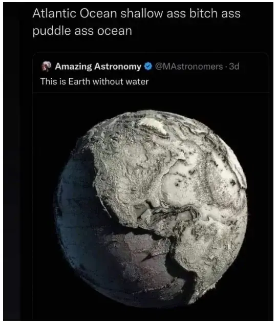
https://ourplnt.com/earth-without-water/
The original is a exaggerated estimate (projection) based on a assumed sphere, probably WGS84, because a lot of the global satellite data is formatted as such.
https://en.wikipedia.org/wiki/List_of_map_projections?wprov=sfla1
"reality" as in extremely exaggerated deviations from the ellipsoid. Otherwise it would just look like a smooth sphere. Earth has 12'700 km diameter. From the shallowest point to mount everest are just about 20 km. That is a 0.15 % change. You would see nothing.
To put in perspective how shallow a 0.15% change is, a dimple on a golf ball is roughly 4 times deeper than that (0.60% of a difference in depth).
Bang on, the Pacific is not 250 miles deep…
"Smoother and rounder than a bowling ball" is my usual comparison
I think that would be too much. A bowling ball is really smooth. It would not roll as well with such deviations all over the place.
At a diameter of 22 cm, the roughness would have to be in the order of 0.3 mm, which would not just be visible due to the distorted reflections, it would even be audible while rolling.
In Finnish language we already have the kinda rare expression "rapakon takana" ("behind the mud puddle") about stuff that's happening in America.
Both the UK and the USA refer to it as "the pond". As in "across the pond".
You VS. the ocean she told you not to worry about.
Atlantic was surveyed in imperial units, Pacific in metric.
"Draining Earth's oceans, revealing the two-thirds of Earth's surface we don't get to see": https://www.youtube.com/watch?v=-uOwv_Krqk8
In this you can see they're about the same depth.
At a global scale, the Mariana Trench and the Everest are the same depth. It's less than 20 Km of difference against a mean diameter of 12742 Km.
Very smooth surface.
Smooth as a shark, as they say
Paddling pool vs. diving zone.